
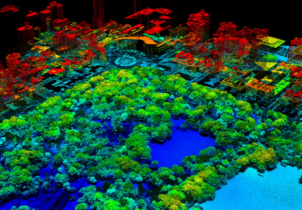
Texas Aerial Support offers drone-based LiDAR surveying for projects that require highly accurate terrain and elevation data. LiDAR is ideal for sites with heavy vegetation or complex topography where traditional photogrammetry may be limited.
Deliverables can include vegetation-filtered topographic surfaces, contours, and TIN models suitable for planning, design, and analysis. Services are tailored to the specific requirements of each site and are well-suited for the diverse and rapidly evolving conditions found across North Texas and the Dallas–Fort Worth region.
What sets this service apart is the use of cutting-edge LiDAR technology combined with construction-aware execution, ensuring data that is both accurate and practical.