
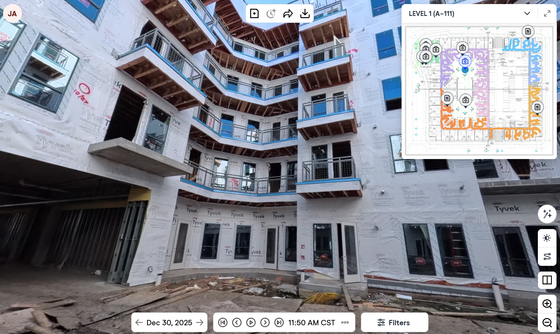
Ground-based interior capture allows project teams to remotely navigate interior spaces using 360° walkthroughs similar to Google Street View. Captures are time-stamped and stored chronologically, allowing teams to revisit conditions at any point in the project timeline.
This service is typically performed on a recurring basis and is ideal for quality control, coordination, RFIs, and documentation. By combining interior and aerial captures into a single platform, teams gain complete jobsite visibility — inside and out.
What makes this service unique is the ability to see work before it was covered, reducing rework, avoiding destructive investigations, and creating a permanent visual record that protects the project long after closeout.
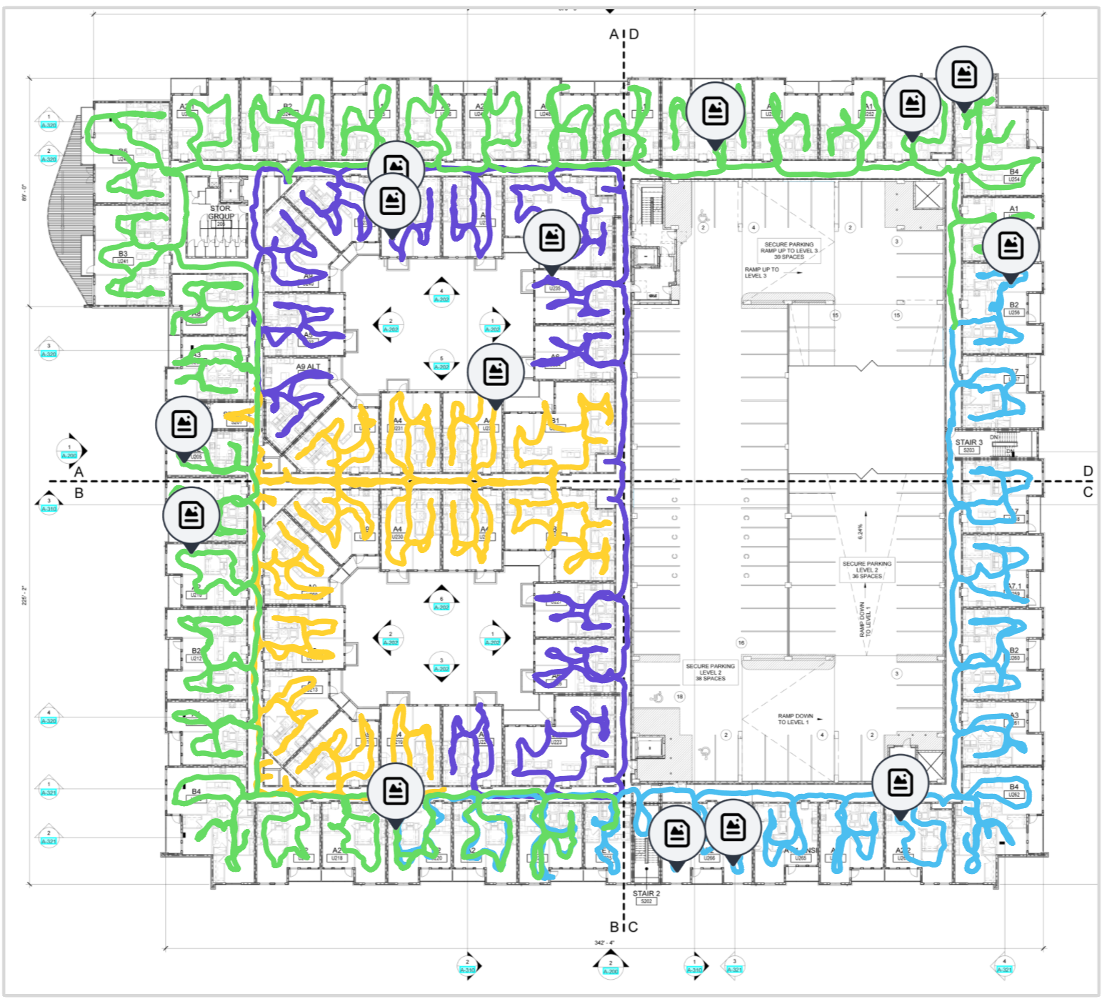